The current version of the complete solution rmDATA Geomatik offers the following new features:
Flexible editing of DWG and DXF data
Use editing commands such as stretching, trimming, offsetting or rounding directly on imported objects - and adjust texts and graphic properties such as color and layer conveniently in the property manager. rmDATA Geoamtik allows you to edit DWG files directly without prior conversion. This allows you to quickly adjust colors, line types or layer assignments as well as update attribute data.
New design methods
Use new construction methods in rmDATA Geomatik for rectangles, parallelograms, 3D circles, 3D arcs and 3D splines for more efficient editing of your data.
Multi-user editing platform extension
With multi-user editing, several users can create and edit project areas at the same time. All work is initially carried out in the background; changes are only transferred to the live database once they have been explicitly applied, ensuring that it remains in a clean, consistent state at all times and that you retain full control over your infrastructure.
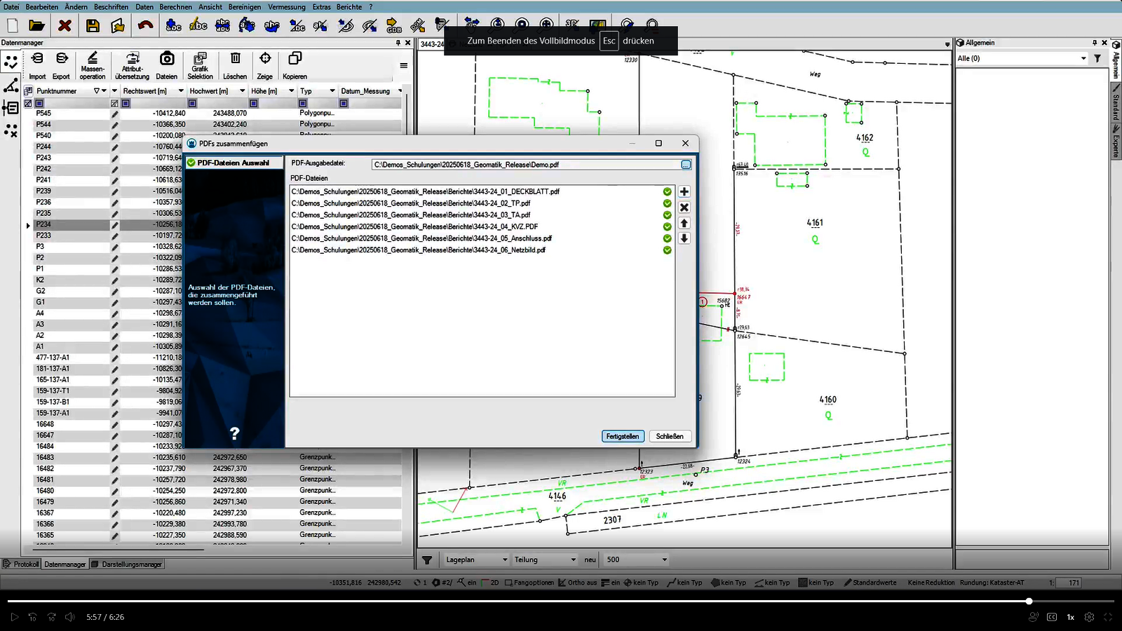
As an authorized Austrian surveyor, you have the option of transmitting plan documents in PDF A 1 B format with form fields to the surveying authority. With the "Merge PDF" function, you can create such plan certificates quickly and easily by merging the individual components.
Further information on these and all other new features can be found in the release notes.
Interested in rmDATA Geomatics?
If you would also like to benefit from the innovative all-in-one platform for geomatics, please contact us. We will be happy to provide you with detailed information.