Network adjustment directly in Geomatik for the first time
Whether constrained, free or dynamic adjustment: surveyors can now calculate their meshes directly in Geomatik. Missing approximation coordinates are generated automatically. This not only saves valuable time, but also increases the reliability of the calculation.
Say goodbye to time wasters: print & design optimized
Another highlight is the option to print several plan areas in one step. This is a massive simplification, especially for offices with extensive projects.
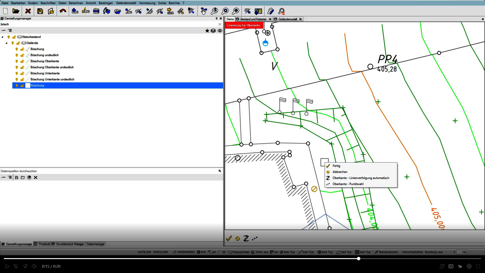
Geomatik 2025.3 also sets new standards when designing slopes: select the top and bottom edges - and the surface is created automatically.
More order with smart mass operations
Renaming points is part of everyday surveying - often tedious and error-prone. With the new mass operation, you can do this in dialog, including a preview of the new point numbers.
Practical additions for the workflow
Extended project templates, flexible protocols and the option to create network images at the touch of a button round off the update.
Interested in rmDATA Geomatik?
rmDATA Geomatik is offered as a software-as-a-service model. This means that the application is provided via the Internet and used by users via a web browser or smart clients - without local installation. This offers numerous advantages: low initial investment thanks to subscription models, rapid implementation, flexible scalability, location-independent access and automatic updates at no additional cost. Are you interested in the rmDATA Geomatics solution? Our experts are always available to answer your questions and provide advice.