Success stories
Successful clients and interesting projects
Successful together - mastering challenges
Find out how companies are setting new standards with our platforms and technologies. From precise surveying, building modeling and digital infrastructure management to efficient project management: our solutions help customers from the fields of geomatics, information systems, reality capturing and project management to successfully achieve their goals.
Discover our success stories now and be inspired!
Customer-oriented services

The Winterthur Geomatics and Surveying Office demonstrates a clear service ethos with expert advice and flexible offerings.
All project data in one place
rmDATA Projects is a popular organizational solution for surveying and engineering firms in Bavaria.
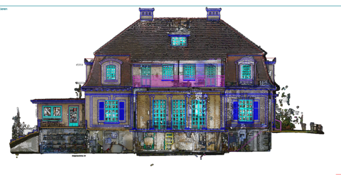
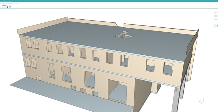
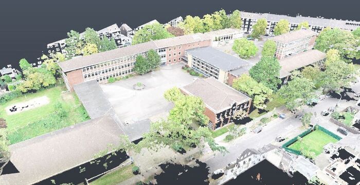
Digital precision for urban redevelopment

How baukult ZT GmbH successfully works with rmDATA 3DWorx and transforms 3D point clouds into submission plans in no time at all.
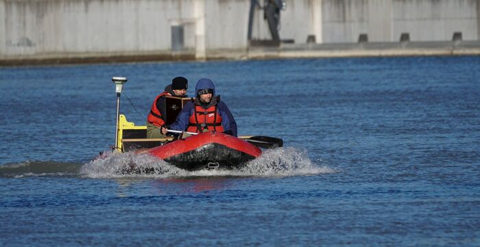
Capture data in real time

VERBUND Hydro Power relies on a comprehensive information system from mDATA that continuously provides users with up-to-date data.
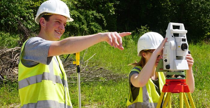
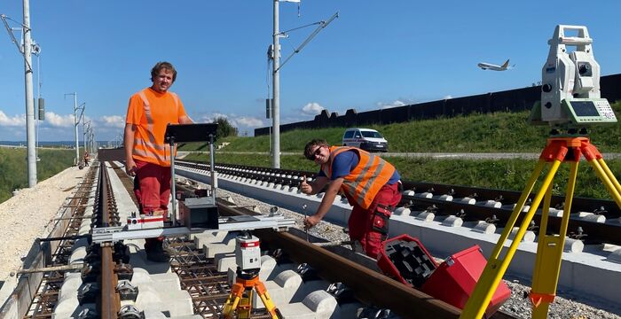
Complex construction site, high demands
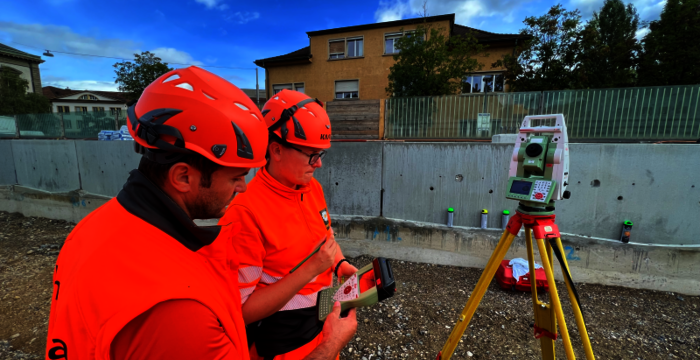
Efficiency counts on the construction site—the surveying team at Implenia ensures accurate project data with software from rmDATA.
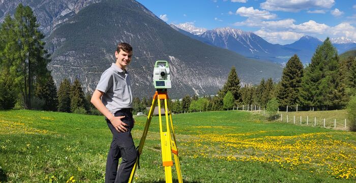
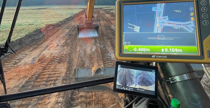
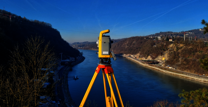
Intelligent machines and proprietary networks
Precise measurements form the basis of every construction project—today, they are supplemented by satellite-controlled machine guidance systems.
Planning principles for building renovation
Refurbishment, renovation, and conversion are booming. The basis for this is reliable existing building plans—a business model for publicly appointed surveyors.
Discovering the BIM workflow for timber construction
How rmDATA 3DWorx is opening up new business areas for Holzbau Ehrlich and enabling renovation projects to be implemented faster, more accurately, and more efficiently.
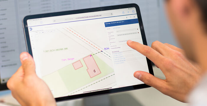
Right of way and land acquisition
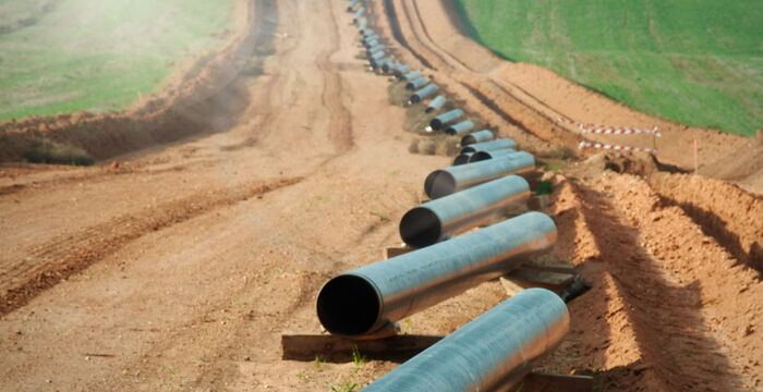
rmDATA introduces a new software solution at OMV, Gas Connect Austria, and Trans Austria Gas Pipeline.
Hersche Ingenieure : région pilote d'Appenzell Rhodes-Intérieures
La solution rmDATA Géomatique est testée dans le canton pilote en vue de l'introduction du nouveau modèle suisse de géodonnées DMAV.
Transformation numérique dans un bureau d'études

Geometris ZT KG recherchait un logiciel d'organisation capable de simplifier et d'optimiser ses processus de travail.
Automated installation information
CableRunner is pushing ahead with the complete digitization of its processes for telecommunications networks—with a customer project from rmDATA.
Consolidation solution for the state of Tyrol
The software solution for consolidation projects is comprehensive and highlights the flexibility of rmDATA's geodetic CAD.
Hochneukirchen municipality works cost-effectively
Staking out, measuring, providing information: rmDATA Smart Infra secures long-term knowledge about infrastructure and helps to avoid unnecessary investments.
From paving to excavator control
How the construction company Karsten Oepen optimizes its projects and work processes using the geodetic CAD software rmDATA GeoMapper.
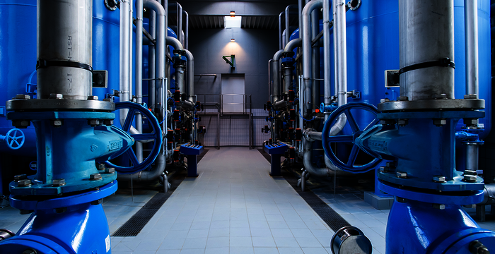
Versorgungssicherheit von Trinkwasser gewährleisten
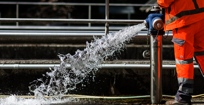
Der Wasserverband Thermenland im Südburgenland entschied sich für rmDATA Smart Infra als All-in-One Lösung, um die wichtige Infrastruktur zu sichern.
rmDATA 3DWorx for the Virtual Factory
Planzeichner Schweiz AG provides technical drawings and planning documents for the real estate industry as well as for architects and civil engineers.
Quality must take precedence over quick profits
Surveyor Rudolf Schöffmann from Leonding in Upper Austria solves demanding surveying challenges.
Digital memory for 400 km of sewer network

The Sewer and Water Authority of the City of Salzburg benefits in its daily work from a customized solution from rmDATA Infosysteme.
From order to time recording
The organizational software from rmDATA maps the entire workflow in the project and employee management of the surveying office GEO-GEM.
Top organization in the surveying office
In order to keep track of its numerous projects, MARKOWSKI Vermessung from Feldkirch opted for the organization software.
Innovativer Einsatz im Holzbau
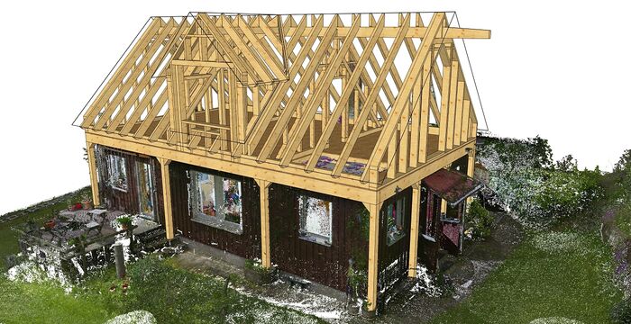
Der Zimmereibetrieb Ehrlich hat mit rmDATA 3DWorx eine innovative Lösung für die Auswertung von Laserscandaten bei Sanierungsprojekten gefunden.
intermetric ist Power-User von GeoMapper
Die flexible Konfigurierbarkeit des geodätischen CAD mittels Python ist ein Alleinstellungsmerkmal, das intermetric aus Stuttgart sehr schätzt.
Stadtgrundkarte führen mit rmDATA-Software
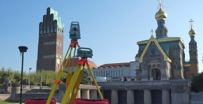
Für das Führen der umfangreichen Stadtgrundkarte in der Wissenschaftsstadt Darmstadt bietet rmDATA mit seinen Produkten eine optimale Lösung.
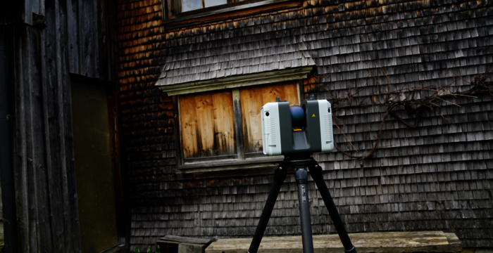
Effiziente Bestandserfassung mit rmDATA 3DWorx
Wie KEMPEN KRAUSE Ingenieure Qualität und Effizienz vereint und den Einsatz moderner Technologien beim Erstellen von Bestandsplänen nutzt.
Türöffner im Holzbau
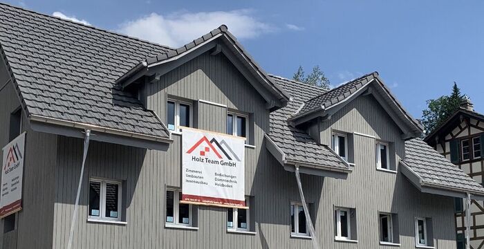
Für einen Zimmereibetrieb eröffnen sich mit Hilfe der Punktwolkenauswertung neue Geschäftsfelder in Richtung Holzbau Engineering.
Präzision am Bau mit dem modernen 3D-Bauaufmaß
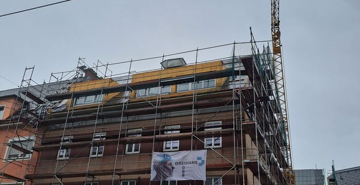
Dreihans GmbH setzt neue Maßstäbe im Bestandsaufmaß mittels Laserscanning, denn der Faktor Zeit spielt beim Aufmaß eine große Rolle.
Erfolgreich netzwerken mit rmDATA Smart Networx
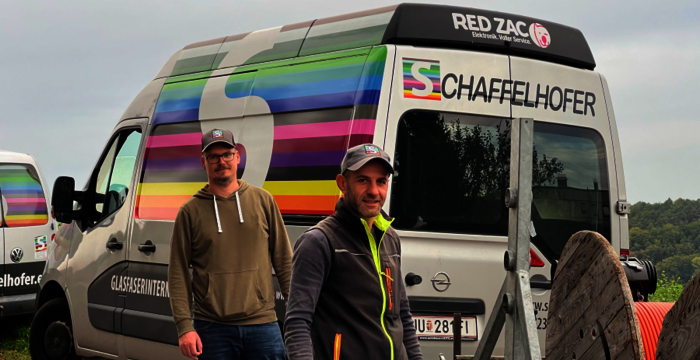
Schaffelhofer GmbH setzt auf rmDATA Smart Networx beim Planen, Errichten und Betreiben ihres Telekommunikations-Netzes.
rmDATA Smart Infra im Wasserverband Südliches Burgenland
Die täglichen Herausforderungen eines Wasserverbandes werden mit Hilfe der Digitalisierung von Prozessen und einer zentralen Software-Lösung gemeistert.
Kommunaler Umsteiger auf Gesamtlösung rmDATA Smart Infra
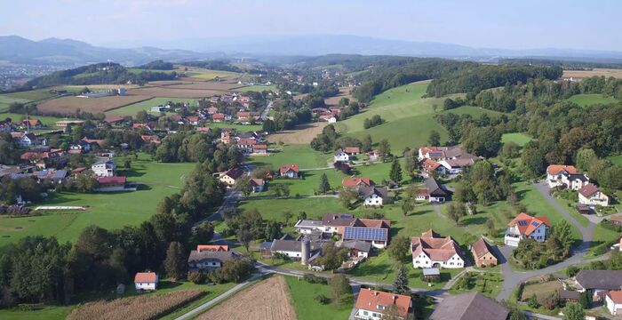
Wie eine steirische Gemeinde durch den Umstieg auf ein webbasiertes Informationssystem ihre kommunale Infrastruktur effizienter verwaltet.
Digitale Transformation im Wirtschaftshof der Stadtgemeinde
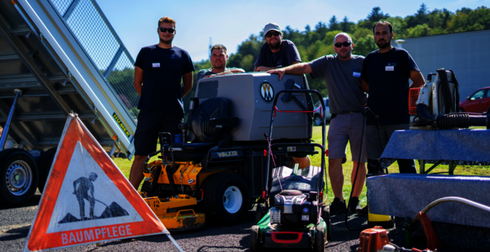
Die Mitarbeiter im Wirtschaftshof der Stadtgemeinde Oberwart schätzen das Informationssystem rmDATA Smart Infra mit der mobilen Aufgabenverwaltung.
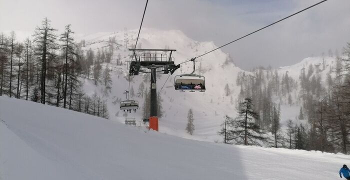
Wissen im Skigebiet nachhaltig sichern
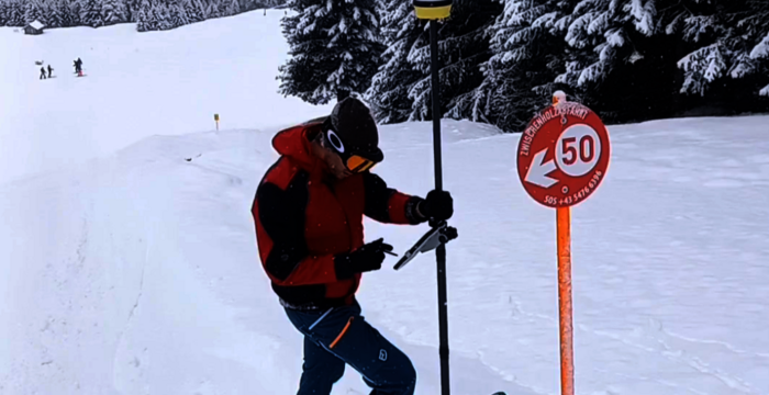
Bergbahnen errichten und verwalten umfangreiche Infrastruktur. Um dieses Wissen jederzeit und überall abzurufen, setzt das Familienskigebiet Christlum auf rmDATA Smart Area.
Digitale Effizienz im Skigebiet Tauplitz
Die Bergbahnen Tauplitz zeigen eindrucksvoll, wie digitale Innovation und praktische Software-Anwendung perfekt zusammenspielen können.
Vom Laserscan bis zur fertigen Stube
Zimmermeister Breu setzt auf das 3D-Bauaufmaß und die Ableitung von Geometrien aus Punktwolken für seine Aufträge.
Workflow für Kubaturen von Schottergruben
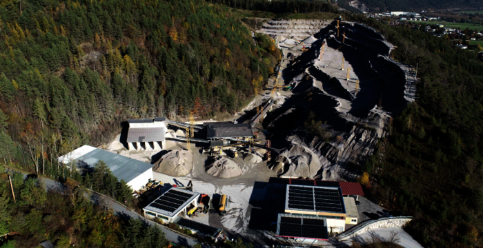
Im Vermessungsbüro GeoSystem bewährt sich der Workflow aus ALS und rmDATA-Software im beim Ermitteln von Kubaturen großer Schottergruben.